Geodetic Survey Icons: More Than Just Points on a Map
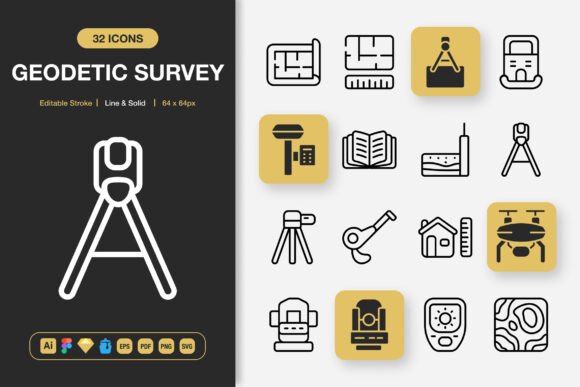
When you hear the term Geodetic Survey Icons, your mind might immediately jump to specialized software for land measurement or complex cartographic tools. That's a valid association, but it's also a limited one. In reality, a high-quality set of geodetic icons represents a versatile visual language. These icons—depicting tripods, benchmarks, satellites, GPS receivers, levels, and topographic symbols—communicate concepts of precision, location, data collection, and analysis. Their inherent minimalist design, often clean and schematic, makes them surprisingly adaptable far beyond their original technical niche.
Where Precision Imagery Finds Unexpected Homes
The strength of a well-crafted Geodetic Survey Icons pack lies in its abstraction. A simple, elegant icon of a survey marker isn't just about land plotting; it's a symbol for accuracy, a foundational point, or verified data. This opens up a world of use cases across industries and creative projects where the metaphor of surveying resonates more than the literal practice.
Enhancing Technical Communication and Education
For engineers, urban planners, or environmental scientists creating public-facing reports, infographics, or presentation decks, these icons provide immediate visual credibility. A community proposal for a new park can use benchmark icons to denote proposed facility locations, making the plan clearer and more professional. Educational materials for geography, geology, or STEM courses benefit immensely. Complex concepts like triangulation or satellite positioning become easier to grasp when accompanied by a clean, solid-style icon rather than a verbose paragraph.
Powering Modern Digital Interfaces
Consider a mobile app for hikers or outdoor enthusiasts. An icon set featuring mountain peaks, compasses, and waypoints can define its visual identity, creating intuitive navigation within the app itself. A website for a data analytics consultancy might use these icons in their hero section to symbolize 'pinpointing insights' or 'mapping business growth'. The line-style versions, with editable strokes, are perfect for creating cohesive, lightweight UI elements that don't overpower the screen.
Fueling Brand and Marketing Projects
The minimalist aesthetic of geodetic symbols aligns perfectly with contemporary design trends that value simplicity and clarity. A startup in the logistics or real estate sector could incorporate a stylized tripod icon into its logo or brand assets to suggest precision and reliability. Flyers, posters, and social media graphics for events like tech conferences or innovation workshops can use these icons to create a theme of exploration, discovery, and solid foundations. They add a layer of conceptual depth without clutter.
A Toolkit for Diverse Creators
The utility of a comprehensive Geodetic Survey Icons set changes depending on who is using it. A graphic designer working on a client's annual report values the multiple file formats—like the Adobe Illustrator source file and EPS—for seamless integration into large-scale print layouts. A UI/UX designer relies on the Figma and Sketch files for rapid prototyping, appreciating the easy drag-and-drop functionality to test icons in mockups quickly. A blogger or content creator creating digital infographics might prioritize the readily available PNG files at various sizes (from 32px for web icons to 512px for featured images) for immediate use without specialized software.
For the solo entrepreneur or small team, the included IconJar file and the straightforward readme.txt can streamline asset management, saving precious time that would otherwise be spent searching through folders or converting formats. The fact that the set includes 100 customizable icons means you have a broad palette to work with without needing to mix and match from disparate packs, ensuring visual consistency across your entire project—whether it's a website, a mobile app, an ebook, or a campaign banner.
Practical Considerations Before You Start
While the versatility is compelling, a few practical thoughts can help you get the most out of such an icon set. First, consider the dominant style you need. The availability of both line and solid styles offers flexibility. Line icons, often with editable strokes, are excellent for intricate designs or when you need a lighter visual weight. Solid styles provide boldness and are highly legible at smaller sizes or on busy backgrounds.
Secondly, think about the technical scope of your project. If you're working across teams or need to hand off assets, the inclusion of source files (like AI) and standard vector formats (SVG, EPS, PDF) is crucial for future edits and scalability. The provided PNGs at specific pixel dimensions are a convenience, but the vector files guarantee your icons remain crisp on any medium, from a smartphone screen to a large-format poster.
A potential limitation to acknowledge is thematic specificity. While these icons are metaphorically flexible, they are still inherently tied to themes of measurement, geography, and data. For a project about organic farming or classical music, the conceptual link might be too strained, and a more directly relevant icon set would be preferable. The key is to assess whether the ideas of mapping, precision, and exploration support your message.
Real-World Application Observations
In observed use, these icons often perform best when they are used to label, categorize, or symbolize a step in a process. For instance, in an instructional ebook about personal finance, a survey marker icon could brilliantly represent the chapter on 'establishing your financial baseline.' In a software dashboard, a satellite icon could denote the 'data sourcing' module. The success lies in pairing the icon with a clear, supportive text label or context, allowing the visual to enhance understanding rather than replace it.
Ultimately, a robust Geodetic Survey Icons set is a resource that changes your projects by offering a coherent, quality-designed visual shorthand. It moves you away from searching for disparate stock imagery or settling for generic clipart. It empowers you to build a consistent visual narrative around themes of accuracy, discovery, and grounded information, whether you're designing a tech app, composing an educational pamphlet, or crafting a brand story that stands on solid ground.